Day 10 – Wednesday 8 April
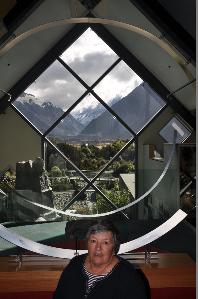
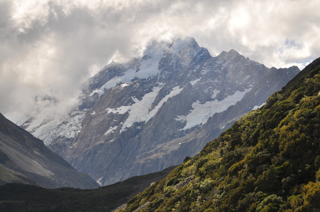
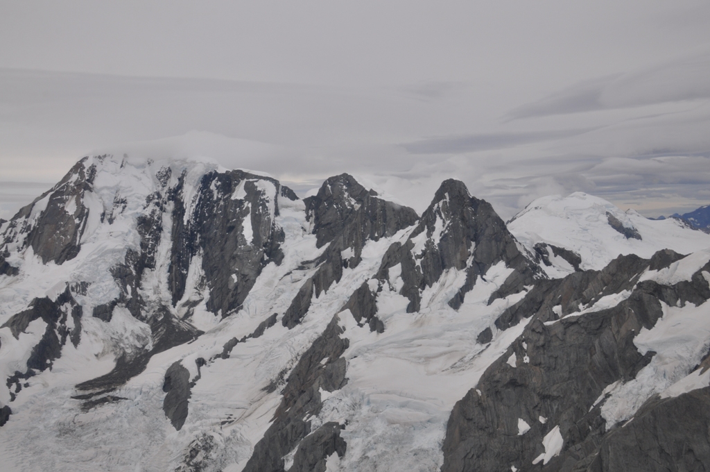
Foggy, cloud & rain overnight, what a disappointment compared to yesterday, we can’t see Mt Cook (Aoraki in its Maori form) from our room like yesterday afternoon, or much else for that matter. We had breakfast at the motel. Fog or no fog we are off to Mt Cook National Park. We drove alongside Lake Pukakaki with the snow covered mountains peaking out in the distance behind the clouds. 50km later we finally reached Mt Cook National Park. First stop was the visitor centre & information desk, very well set out display on the park, over two floors, with some of the history as well. Framed at the end of the building in floor to ceiling glass is Mt Cook & his brothers, covered in snow & glacial ice (the part that wasn’t covered with cloud that is).
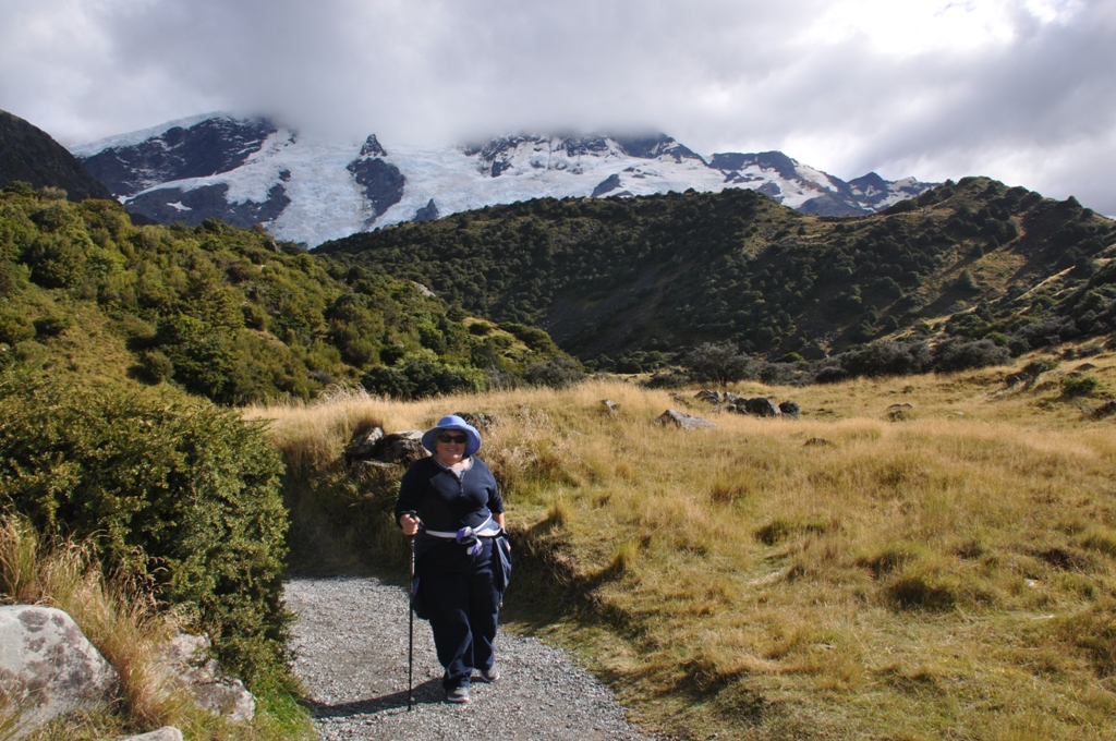
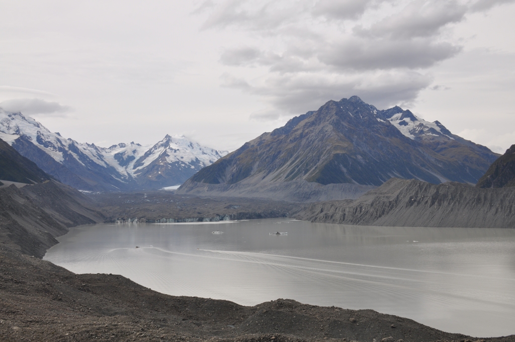
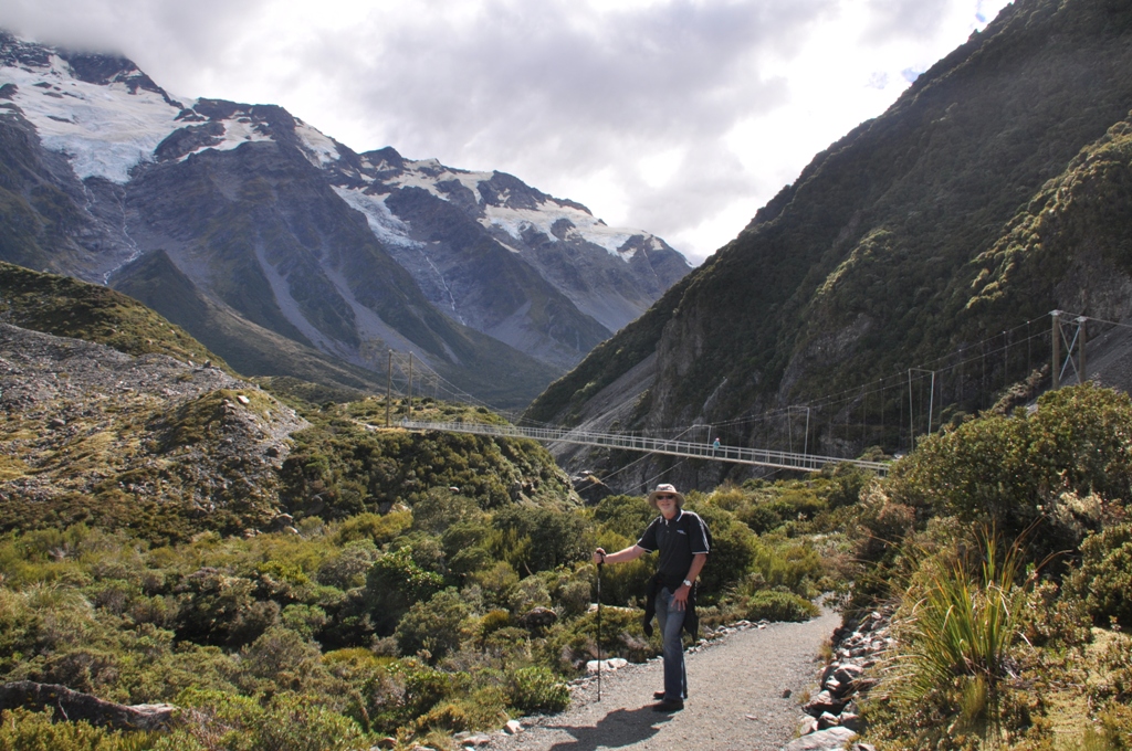
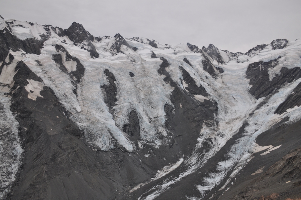
A friendly ranger gave us some suggestions on short walks to do (hours, not days) & we headed out on the Hoopers Crossing walk. This walk is rated as a three hour walk crossing the very fast flowing Pukakaki River twice just after it leaves the glacial lake at the base of the mountain range. There are a large number of glaciers which feed into this lake & the walk gives a wonderful view of the dark green & white ice of the different glaciers with waterfalls flowing from the base of them, up until where the cloud covers it at least. After a bit over an hour we crossed the 2nd suspension bridge & just past this the view to Mt Cook opened up, conveniently right where a very large park bench was set up. We stopped & sat for a while, soaked in the views, rested our weary bones, had a drink & a bite to eat, then rested a bit more. The walk back was mostly downhill, apart from the steps after the 1st suspension bridge which tested us as it was all up & a lot of them. We returned to the car in around 2 ½ hours. At the park cafe we had a well deserved cuppa & lunch.
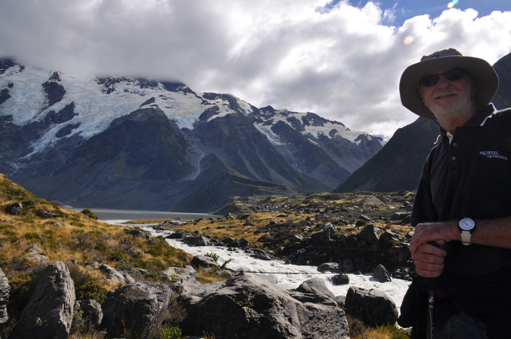
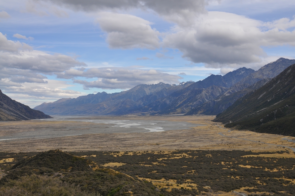
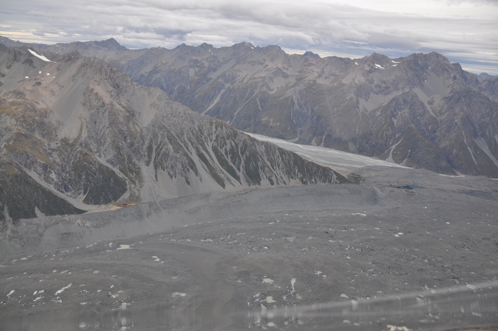
After lunch we drove 8km to the base of the Tasman Glacier moraine (very large pile of glacial rocks) where I left Tereza at the car for the 15 minute walk up the very steep & rocky path. My thighs were burning as I neared the top & the breathing was fairly heavy as well. The view looking at the very wide face of the Tasman Glacier & overlooking the very large glacial lake, that had a few very large icebergs floating around, was a lot better than the blue lake that I had passed on the way up. The Blue Lake was a drab greeny brown & more a pond, I’m sure it looked special at some time. The Tasman Glacier lake had 3 inflatable boats with about 8 people in each motoring up the lake & the boats looked tiny on the lake next to the icebergs.
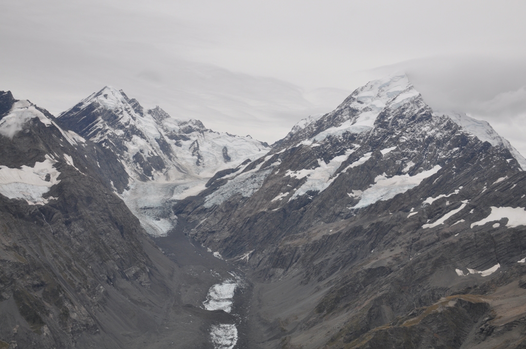
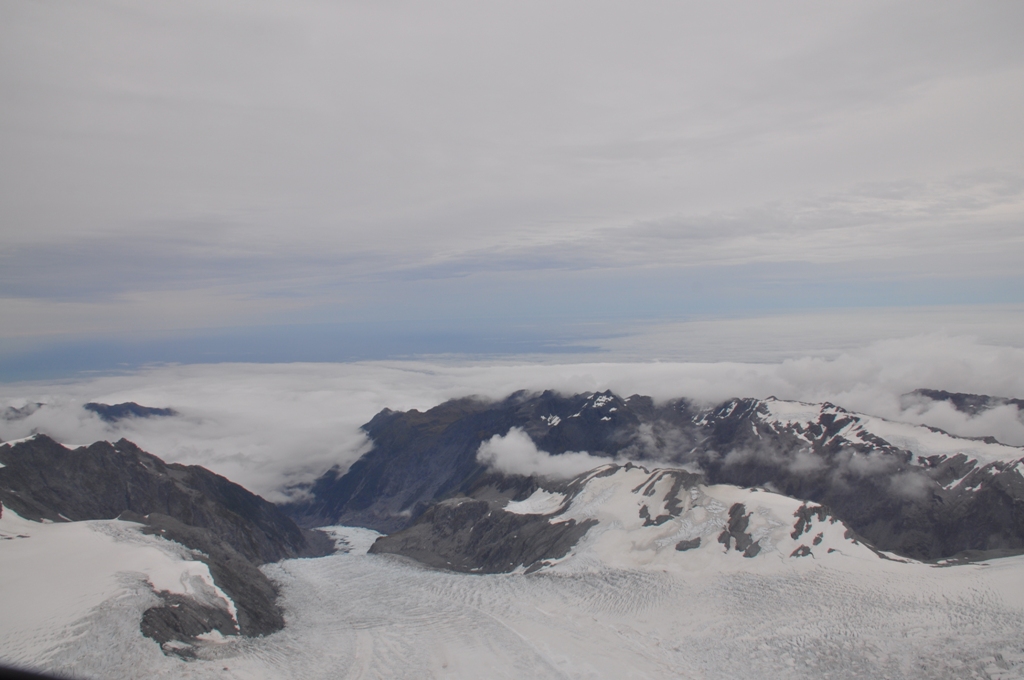
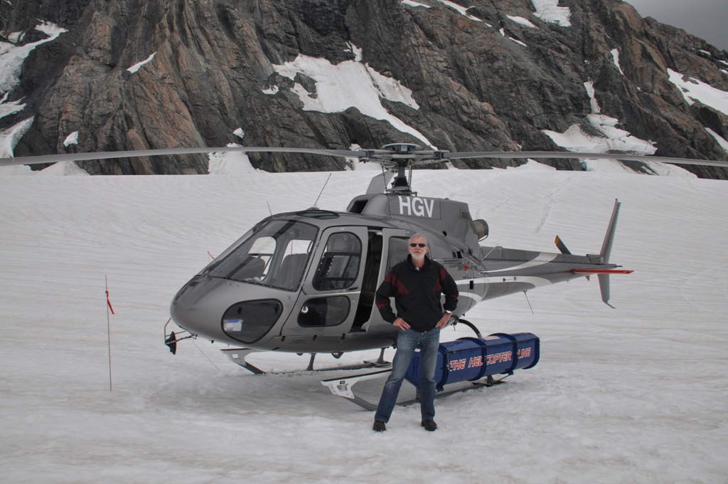
Next stop was Mt Cook Airport & a helicopter ride over the New Zealand Alps. The cloud had been clearing slowly all day & thankfully when we got to the airport it had opened up enough for us to fly, even over the two west coast glaciers, the Franz Joseph & the Cook Glacier. The west coast helicopters were grounded as the cloud cover was complete & low at the Franz Joseph Airport. Firstly we flew up to the southern face of Mt Cook, looking clearly at all 3,754 metres of it before heading west over the alps. We flew over the top of both the Cook & Franz Joseph Glaciers. Our pilot got an SOS call that at the Burns Hut near the top of the Cook Glacier a group of nine hikers had become trapped on the ice overnight & had to sleep on the ice in the overnight rain as the pathway to the hut was blocked by a very large crevasse. One of them somehow got to the hut to make the radio call for help. They were cold, wet & very tired. Our pilot was being co-ordinated with another helicopter pilot to pick the group up before nightfall & before the weather closed in again. The forecast for tonight & the next day or two on the mountain is for rain then snow next Monday. When the pilot finished with us & dropped us off at the airport, he would refuel & fly back to pick them up, take them off the ice & to Glen Tanner airport (about 20km from Mt Cook Airport) where accommodation had been arranged for them tonight. It was so lucky for these hikers that they got the call through when they did because it was getting late we were the last flight before they closed.
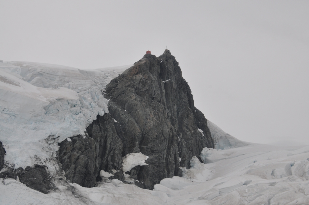
After that bit of excitement we circled around the back of Mt Cook & landed on the top end of the Tasman Glacier, about 6,600 feet above sea level. The pilot turned off the motor & we walked onto the snow & soaked in the atmosphere. Absolute quite, apart from an avalanche in the distance, snow crunching under our feet. Huge chunks of ice piled up & surrounded by huge mountains added to the experience & re-enforced how insignificant we are. The sight is breathtakingly beautiful every direction that we looked. Back into the helicopter & thankfully it started again & we are off on our adventure again, following the Tasman Glacier all the way down to its glacier lake then looking at the spot both on Mt Cook & down at the end of the Tasman Glacier where you can still see the remnants of a giant avalanche. Giant as in Mt Cook lost 10 metres height & 55 million cubic metres of rock that slid 2,600 metres down the mountain side. In Twizel, 70km away the event registered 3.4 on the Richter Scale, it was that big.
Absolutely breathtakingly beautiful sums up the experience of seeing the Southern Alps from the air & ground. All too soon we were back on the ground (& for the pilot to hurry up & try to rescue those poor people) on the road again for tonight’s destination of Lake Tekapo. Our accommodation is amazing, it’s almost as big as our house in Canberra. Our dinner in the restaurant was absolutely superb.
Our aching muscles will appreciate the rest – it is all worth it, we had the BESTEST adventure.