Day 13 – September 13 2012
After a balmy evening it changed into a very windy night & we even had some rain drops. I hoped that we wouldn’t have rain because the rough dirt road we came in on would be too slippery to get out of here. We woke to a dry but a cold windy morning.
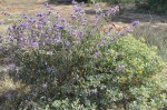
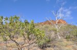
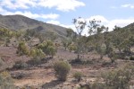
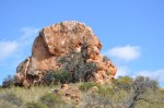
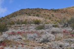
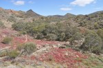
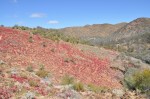
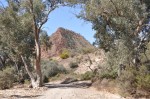
We set off at 8am on the 8km Mawson-Spriggina bushwalk, with a starting altitude of 330m rising to 496m on Spriggina Ridge. The walk starts at Arkaroola Village & follows Wywhyana Creek along the Mawson Valley. The wildflowers are out in profusion, with the small red flowered hop bush absolutely everywhere & contrasting delightfully with the greens & greys of the surrounding landscape plus the yellows of all the different varieties of wattle in flower & the purple of the native fuschia. Mt Oliphant dominates the Mawson Valley, but as we walked on, The Pinnacles stood out, these are eroded remnants of plugs of granite that intruded through the overlaying sedimentary rock around 450 million years ago. This landscape in the Flinders is very old. We failed to spot any of the yellow footed rock wallabies that inhabit The Pinnacles, I think we may have been too late for them.
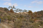
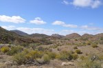
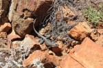
The creeks have many interesting shaped trees & are full of birds of all varieties. We did have a special treat when a red robin displayed himself close to us & an orange bellied blue coloured dragon lizard allowed us to get very close & photograph. The path was very rocky, with an amazing array of different rocks & minerals all over the place. This region of the Gammon Ranges is very rich in minerals, with a cluster of old copper mines nearby. As we climbed the ridge out of the Mawson Valley we were treated to some great views all around us, again the photos do not do it any justice.
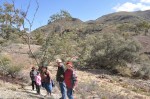
We were at the half-way point so broke out the morning snacks to give us the energy for the rest of the walk. Tereza is coping very well with her dodgy knees walking up & down & around & across on these very uneven rocky paths. The walk to the top of the astronomy lookout was a bit of a test with a steep climb up to the twin observatories complete with solar panels, batteries & two-way satellite dish. The view from here was spectacular with a 360 degree view of the Gammon Ranges. The rest of the walk was mostly downhill from here, a lot easier (for those with good knees) after 6km of up & down, with some more stunning displays of wildflowers along the track.
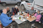
We finished the walk in around 4 1/2 hours, taking it easy, back at camp we had had our lunch. The afternoon was fairly quiet with some reading & resting after the morning walk. Again we had a great shared BBQ dinner with our friends to finish off another great day under clear blue skies.